Roaring Fork Colorado Fishing: River Access, Flows & CPW Rules
The Roaring Fork is not a “show up anywhere and wade” river. It changes fast with runoff, releases, storms, private-property edges, float traffic and special CPW regulations.
This guide gives you a practical workflow: check USGS flow first, read CPW rules second, choose legal public access third, then decide whether to wade, float or wait.
Last reviewed: June 25, 2026. Always verify live flows, weather, private-property boundaries, CPW rules and access signs before entering the river.
Quick Answer: How Should You Plan a Roaring Fork Fishing Trip?
Check the river flow first, then the CPW rules, then your access point. The Roaring Fork can fish well, but high water, unclear access and special regulations can quickly turn a good plan into a bad one.
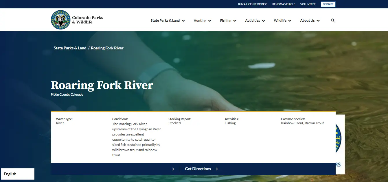
CPW describes the Roaring Fork upstream of the Fryingpan River as a quality fishery sustained primarily by wild brown trout and rainbow trout. But your exact section decides your legal gear and harvest rule.
Flow first
Use USGS Aspen for upper-river trend and USGS Glenwood Springs for lower-river trend. Rising, muddy or pushy water is a warning sign.
Rule second
Maroon Creek to upper Woody Creek Bridge is artificial flies only with all trout released immediately.
Access third
Use signed public access, CPW SWA pages, local maps and posted boundaries. A fishing license does not unlock private land.
Official Flow Screenshot: USGS Roaring Fork River Conditions Page
This screenshot is placed near the start so readers can recognize the official USGS water-data layout before checking live river conditions.
Watch First: Roaring Fork River Fishing Visual Guide
This video is useful for seeing the river setting around Basalt, Aspen, Carbondale and Snowmass before planning access. Use it for visual context, not legal rules.
Roaring Fork River Conditions: How to Read Flows Before Fishing
Do not ask “Is the Roaring Fork fishing?” before asking “What is the river doing?” Flow trend matters as much as the number. Rising, dirty or fast water can make wading unsafe even when the weather looks good.
| Official Gage | Use It For | Practical Angler Read |
|---|---|---|
| USGS Roaring Fork River near Aspen | Upper-river condition trend near Aspen. | Useful before fishing upper valley sections, especially around snowmelt or mountain storms. |
| USGS Roaring Fork River at Glenwood Springs | Lower-river condition trend near the Colorado River confluence. | Useful before lower-river wade or float plans, especially below Carbondale. |
| Weather radar and forecast | Storm and runoff context. | A clear parking lot does not mean the upstream drainage is clear. |
| Local shop or guide report | Clarity, hatch and access notes. | Useful after official gage check, not instead of it. |
Flow Decision Tree
Check the right USGS gage
Aspen for upper river. Glenwood Springs for lower river. If fishing between them, compare both to understand the bigger trend.
Look at trend, not only number
A river rising quickly can be harder and more dangerous than a stable river at a similar flow.
Check water clarity
Runoff, rain and tributaries can reduce visibility. If you cannot see safe footing, wading risk increases.
Decide wade or float
Low, clear and stable can suit wade anglers. Higher pushy water may be float-only or not worth fishing.
Official flow pages: USGS Roaring Fork River near Aspen and USGS Roaring Fork River at Glenwood Springs.
CPW Roaring Fork River Rules: Section-by-Section
Roaring Fork rules are section-specific. Do not use one rule for the whole river. CPW’s special regulations are the legal starting point before you decide flies, lures or harvest.
| River Section | CPW Rule Summary | What It Means in Plain English |
|---|---|---|
| Maroon Creek downstream to upper Woody Creek Bridge | Artificial flies only. All trout must be returned to the water immediately upon catch. | Fly-fishing only. Treat this as catch-and-release for trout. No bait, no keeping trout. |
| Upper Woody Creek Bridge downstream to the Fryingpan River | Artificial flies and lures only. Trout bag and possession limit is two fish, minimum 16 inches. | No bait. If keeping trout, they must meet the size and count rule. Many anglers still release fish here. |
| Other stretches | Check the current Colorado Fishing Brochure and CPW page. | Do not assume the same rule continues downstream or upstream without checking. |
Verify the current legal wording on the official CPW Roaring Fork River page.
Roaring Fork River Access: Aspen to Glenwood Springs
The Roaring Fork flows through canyons, open space, farmland, towns and private-property edges. CPW notes that many stretches have public access for shore, wade and adventurous float anglers, but “many” does not mean “everywhere.”
| Area | Best Use | Access Warning |
|---|---|---|
| Aspen / upper valley | Smaller-water feel, upper-river conditions, fly-focused planning. | Check Maroon Creek to upper Woody Creek Bridge rule carefully. |
| Woody Creek area | Public access pockets and technical trout water. | Bridge boundaries matter for gear and harvest rules. |
| Basalt / Fryingpan confluence area | Key transition zone, larger river, popular angling corridor. | Heavy pressure and private-property edges require careful access choices. |
| Carbondale / Burry SWA | Gold Medal fishing easement and a strong access option. | SWA access rules apply to visitors age 16+. |
| Glenwood Springs lower river | Lower-river condition checks, float planning and confluence context. | Use the Glenwood Springs USGS gage for lower-river trend. |
Burry SWA: Gold Medal Access Near Carbondale
Burry SWA is one of the most useful official access references for Roaring Fork anglers. CPW says the Burry parcel is a fishing easement along 1.25 miles of Gold Medal waters on the Roaring Fork River about four miles northwest of Carbondale on Highway 82.
Gold Medal water
This is the kind of access readers should bookmark because it connects public-use planning with known quality water.
SWA access proof
CPW says everyone 16 or older accessing this SWA needs a valid hunting or fishing license or SWA pass.
Restrictions matter
CPW lists Burry SWA as open for fishing only, with access limited to designated areas as posted, and dogs prohibited.
Check the official CPW Burry SWA page before going.
Local Tips: How to Fish the Roaring Fork Smarter
Thin fishing pages say “great trout river.” Useful pages tell you what actually changes your day: flow, access, water clarity, bridge boundaries, wading safety and whether you should hire a guide or float.
Start early in summer
Morning often gives cooler water, cleaner light, less traffic and a better chance before heat or afternoon storms.
Respect runoff
Spring and early-summer flows can be pushy. A river can look fishable from the bank and still be unsafe to cross.
Use traction
Slick rocks, fast seams and boulders make felt alternatives, rubber traction, studs or a wading staff worth considering.
Match the section rule
Artificial flies only is not the same as artificial flies and lures only. Know your section before rigging.
Download maps
Save USGS gages, CPW page, access pins and license proof before entering weak-service canyon or valley sections.
Clean gear
Clean, drain and dry waders, boots, nets, rafts and boats before moving between waters.
Best Time by Fishing Style
| Trip Type | Best Planning Window | Why |
|---|---|---|
| Wade fishing | Stable or falling flows, good clarity | Safer footing and better line control. |
| Float fishing | Enough flow, legal access, proper craft and shuttle plan | Float anglers can cover water that wade anglers cannot reach. |
| Dry fly day | Clear water, active hatch, calmer wind | Presentation and visibility matter more than just being on the river. |
| Streamer or high-water strategy | Careful flow check, edge fishing, guide-level caution | Powerful water can fish, but it punishes poor wading decisions. |
| Winter fishing | Milder windows, safe access and clear shelf-ice judgment | Lower elevation can help, but ice and footing still matter. |
Colorado Fishing License Reminder for the Roaring Fork
Most anglers age 16 or older need a valid Colorado fishing license before fishing the Roaring Fork. If you enter Burry SWA or another State Wildlife Area, access proof may also matter.
Need the license workflow?
Use the complete Colorado fishing license guide for CPW Shop steps, fees, age rules, proof, Habitat Stamp notes, second-rod stamp and SWA access reminders.
Planning another mountain trip?
If your Colorado fishing route also includes high-country lake fishing, compare river rules with lake-specific access and trout limits.
Roaring Fork Problem Solver: What to Do When Plans Change
Use this section when something feels unclear on the morning of your trip.
| Problem | Do This First | Do Not Do This |
|---|---|---|
| River is rising fast | Move to safer bank water, wait, or choose another water. | Do not force a crossing because the gage number looked okay yesterday. |
| Water is dirty after rain | Check upstream weather and tributary impact, then adjust method or location. | Do not assume the whole river is the same clarity. |
| You are unsure which rule section you are in | Use maps, bridge names and CPW boundaries before fishing or keeping fish. | Do not keep trout if you cannot place yourself legally. |
| Access looks private | Leave it, find signed public access, or use official maps. | Do not cross fences or posted areas because the river is public water. |
| Burry SWA parking/access is confusing | Open the CPW Burry SWA map/page and follow posted designated areas. | Do not bring dogs or use areas outside posted access. |
| You forgot license proof | Recover CPW proof before fishing. | Do not fish first and solve proof later. |
Common Roaring Fork Fishing Mistakes to Avoid
- Checking only one gage: Aspen and Glenwood Springs can tell different parts of the river story.
- Ignoring trend: rising water can be worse than a stable higher number.
- Using bait in restricted water: special sections require artificial flies or artificial flies/lures only.
- Keeping trout in the wrong section: Maroon Creek to upper Woody Creek Bridge requires immediate trout release.
- Crossing private land: public water does not erase private-property boundaries.
- Entering Burry SWA without access proof: visitors 16+ need a valid hunting/fishing license or SWA pass.
- Bringing a dog to Burry SWA: CPW lists dogs as prohibited there.
- Skipping gear cleaning: clean, drain and dry gear before moving between waters.
Official Links for Final Verification
Use these official pages before you fish. The goal is not more clicks; the goal is preventing bad river decisions.
Use for species, conditions, special regulations and CPW river-specific guidance.
Use for upper-river flow and gage trend before fishing Aspen-side sections.
Use for lower-river trend before fishing or floating downstream sections.
Use for Gold Medal access, SWA access requirements, restrictions, directions and CPW office contact.
Use for access, species, special regulations and map-based planning.
Use to buy the correct Colorado fishing license, stamp or pass before fishing.
Roaring Fork Colorado Fishing FAQs
Do I need a Colorado fishing license for the Roaring Fork River?
Yes, most anglers age 16 or older need a valid Colorado fishing license before fishing the Roaring Fork River.
What fish are in the Roaring Fork River?
CPW lists rainbow trout and brown trout as common species, and describes the upper river fishery as sustained primarily by wild brown trout and rainbow trout.
Where should I check Roaring Fork River conditions?
Use USGS Roaring Fork River near Aspen for the upper river and USGS Roaring Fork River at Glenwood Springs for the lower river trend.
Can I use bait on the Roaring Fork River?
Not in the special-regulation sections listed by CPW. Some sections require artificial flies only, while others allow artificial flies and lures only.
What is the rule from Maroon Creek to upper Woody Creek Bridge?
CPW lists this section as artificial flies only, with all trout returned to the water immediately upon catch.
What is the rule from upper Woody Creek Bridge to the Fryingpan River?
CPW lists this section as artificial flies and lures only, with trout bag and possession limit of two fish and a 16-inch minimum size.
Is Burry SWA good for Roaring Fork access?
Yes. CPW says the Burry parcel is a fishing easement along 1.25 miles of Gold Medal waters on the Roaring Fork River near Carbondale.
Do I need an SWA pass at Burry SWA?
CPW says everyone 16 or older accessing Burry SWA needs a valid hunting or fishing license or SWA pass.
Can I bring a dog to Burry SWA?
No. CPW lists dogs as prohibited at Burry SWA.
Is the Roaring Fork better for wading or floating?
It depends on flow, section and access. Stable lower flows can suit wading, while bigger water may require float experience or a guide. Check USGS gages first.
Independent Guide Disclaimer
This guide helps anglers plan a safer, smarter Roaring Fork River trip, but it is not an official Colorado Parks and Wildlife, USGS or State Wildlife Area page.